
Loading live conditions...
Loading live conditions...
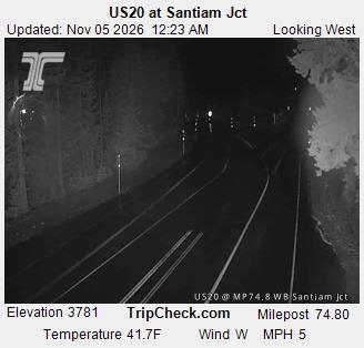
Santiam Pass is open, carry chains or traction tires, road surface: bare pavement, 38 degrees at the summit, updated NOV 4, 2026, 8:19 PM PST.
Last updated at: NOV 4, 2026, 8:19 PM PST · ODOT
 LIVE
 LIVE
 LIVE
 LIVE
 LIVE
 LIVE
Road surface at the pass: bare pavement. Temperature at the summit: 38°F. Weather: rain.
Road surface at the pass: bare pavement. Temperature at the summit: 38°F. Weather: rain.
Santiam Pass carries US 20 over the Cascades at 4,817 feet, between Sweet Home and Albany on the west side and Sisters and Bend on the east. It is the Salem and mid valley route into Central Oregon, and the pass Portland drivers reach for when they want off the interstate.
The highway climbs the Santiam River canyon past Santiam Junction, where OR 22 comes in from Salem, and crosses the crest beside the Santiam Pass ski area. The live posting on this page is the same ODOT report the road signs read, and the summit cameras show the road before you commit to the climb.
Planning around the weather? See the Santiam Pass weather forecast for the summit, hour by hour. Crossing the mountains the other way? Siskiyou Summit conditions on I-5 update from the same ODOT reports.
US 20 over Santiam Pass is a two lane highway for most of the climb, with grades that run 5 to 6 percent on the west side and a long, curving descent into Sisters. Trucks chain up at the wide shoulders near Santiam Junction and at the summit pullouts; ODOT's postings apply to towing vehicles earlier than to solo cars, so a trailer combination can be required to chain while cars are still on traction tires. RV drivers should know the east side descent is the brake burner: drop a gear at the crest, not halfway down. There is no truck escape ramp on this crossing, which is exactly why the chain postings go up early here.
The practical decision point is Santiam Junction, where OR 22 from Salem joins US 20 at about 3,800 feet. If the summit cameras show packed snow and the posting is up, chain at the junction where there is room to work, instead of on the shoulder in traffic higher up. Westbound, Sweet Home is the last fuel and services stop before the climb. The ski area lot at the summit is not a chain up area; use the highway pullouts and keep the travel lane clear, because a stopped vehicle in the lane on this highway is how the pass closes.
Santiam and Willamette passes sit in different parts of the range and ODOT posts them independently. When a warm storm floods the Santiam River canyon, OR 22 and US 20 can close for slides and debris while Willamette runs clean, and the reverse happens when a cold pool settles over the OR 58 summit. The Salem to Bend page on this site puts this pass in its corridor context, and the Eugene to Bend page compares the two summits side by side. If both passes are posted at the top level, the honest move is to wait in the valley; there is no low elevation back road across this part of the Cascades.
Every posting change on this pass is logged in public: see the Santiam Pass status history.
Incoming storms, road conditions, and ski area news, straight to your inbox.